Long distance
Cross Borders Drove Road
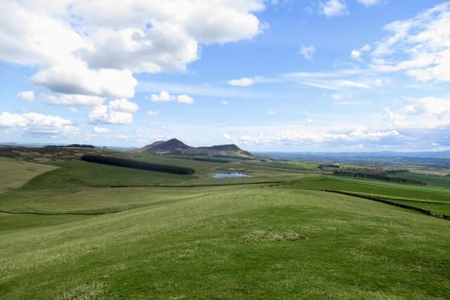
Follows ancient cattle-droving routes through the heart of the Scottish Borders hill country. Rolling moorland, hidden valleys and a genuine sense of stepping back in time. Best walked best south-to-north over 4 days. The full route covers 84 km (52 mi) with 2,000 m of climbing — a manageable mid-distance route.
Quick facts
- Distance
- 84 km/ 52 mi
- Typical days
- 4
- Total ascent
- 2000 m
- Difficulty
- moderate
- Start → Finish
- Hawick → Lauder
- Best direction
- South to North
- Water sources
- Peebles, Innerleithen, Traquair, Selkirk — all the Borders towns at either end have taps and shops. The middle moorland sections cross the Minch Moor and Three Brethren — burns are reliable but exposed. Carry 1.5L between Innerleithen and Selkirk.
- Mobile signal
- EE/Vodafone reliable in Peebles, Innerleithen, Traquair and Selkirk. The Minch Moor and Three Brethren high ground is out of signal. The route passes briefly through Glentress forest where signal recovers.
✔ Waymarked throughout
Approximate profile derived from per-stage ascent — accurate on total climb and pattern, not a pixel-precise GPX trace.
Our take
The Cross Borders Drove Road passes through some of the emptiest hill country in southern Scotland. The Cheviots and Lammermuirs have a bleak beauty that rewards solitude-seekers. Navigation is straightforward on the waymarked route but can be tricky if you stray. Hawick and Lauder are characterful Border towns worth exploring.
Highlights
- Hawick and the Borders textile heritage
- Craik Forest
- Ettrick Valley
- Lauderdale approach to Lauder
Day-by-day itinerary
A suggested 4-day schedule. Adjust to your fitness and conditions.
1Hawick to Roberton18km · 500m ascent
From the textile town of Hawick up into the Borders hills along ancient drove roads to the hamlet of Roberton in the Borthwick Water valley.
- Terrain
- Hill tracks, moorland paths, old drove roads. Steady climbing.
- Overnight
- Roberton has very limited B&Bs. Wild camping works well on the moors.
- Stats
- Hawick → Roberton · 18km · ↑500m
2Roberton to Traquair24km · 600m ascent
Over Craik Moor and through the forest to Traquair in the Tweed valley. The most remote section with big views across the empty Borders hills.
- Terrain
- Moorland tracks, forest roads, hill paths. Remote and exposed.
- Overnight
- Traquair has B&Bs. Innerleithen is 2km away with more options.
- Stats
- Roberton → Traquair · 24km · ↑600m
3Traquair to Lauder (via Galashiels)22km · 450m ascent
Through the Tweed valley past the Minch Moor ridge to Galashiels. Rolling farmland and panoramic views from the ridgeline.
- Terrain
- Ridge paths, farm tracks, descent into the Tweed valley.
- Overnight
- Galashiels has hotels and B&Bs. Good resupply point.
- Stats
- Traquair → Galashiels · 22km · ↑450m
4Galashiels to Lauder20km · 450m ascent
Over the Lauderdale hills on the final stretch of drove road to the Royal Burgh of Lauder. Open moorland and big skies to the finish.
- Terrain
- Hill paths, moorland tracks, descent to Lauderdale.
- Overnight
- Lauder has the Black Bull Hotel and B&Bs. A characterful Borders finish.
- Stats
- Galashiels → Lauder · 20km · ↑450m
Transport
To start (Hawick)
Bus · Borders Buses
Service X62 Edinburgh–Peebles–Galashiels (every 30 min) serves Peebles
Check times & book →
From finish (Lauder)
Bus · Lothian Country Buses
Service 44 from Edinburgh to Kirknewton
Harperrig itself is unserved (Little Vantage stop on A70 has no scheduled service — walkers typically use Kirknewton ~3 miles away).
Check times & book →
Best months
Accommodation
B&Bs at Hawick, Roberton and Lauder. Wild camping works well on the moorland sections. B&Bs in Hawick, Traquair (and nearby Innerleithen), Galashiels and Lauder; wild camping on the moorland sections is the obvious mid-route option in summer.
Night-by-night guide: where to stay →Resupply
Hawick has full shops. Very limited between Hawick and Lauder — carry 2 days of food. Co-op and Tesco at Hawick, Innerleithen, Galashiels and Lauder; longest gap is around 25km on the Roberton-to-Traquair stage — carry a packed lunch and snacks.
Connect with
Chain into a longer expedition by combining with adjacent long-distance routes.
Current conditions
Weather at the start point (Hawick)
Daylight Today
- Sunrise
- 05:14
- Sunset
- 21:21
- Civil dawn
- 04:26
- Civil dusk
- 22:09
NOAA Solar Calculator · 30 July 2026
Share your experience
Walked the Cross Borders Drove Road? Help others plan their trip.
Getting to and from the Cross Borders Drove Road
Train and town anchors at each end of the route — on TripSCOT.