Long distance
Clyde Walkway
Follows the River Clyde from the centre of Glasgow upstream to the UNESCO World Heritage Site of New Lanark and the Falls of Clyde. Urban, suburban and then genuinely rural. Best walked in either direction over 3 days. The full route covers 65 km (40 mi) with 600 m of climbing — a friendly short trail.
Quick facts
- Distance
- 65 km/ 40 mi
- Typical days
- 3
- Total ascent
- 600 m
- Difficulty
- easy
- Start → Finish
- Glasgow → New Lanark
- Best direction
- Either direction
- Water sources
- Glasgow Green, Cambuslang, Uddingston, Hamilton, Motherwell, Wishaw, Lanark, New Lanark — taps and shops throughout. The route follows the river with frequent benches, picnic spots and water access. Never more than 3km from a fill point.
- Mobile signal
- EE/Vodafone/O2 continuous along the populated Clyde corridor. No serious signal gaps for the entire length. Glasgow to Lanark is one of the most mobile-friendly long-distance routes in Scotland.
✔ Waymarked throughout
Approximate profile derived from per-stage ascent — accurate on total climb and pattern, not a pixel-precise GPX trace.
Our take
The Clyde Walkway is the most accessible long-distance route in Scotland — you can walk from Glasgow Central station. The first section through the city is urban riverside regeneration; the middle section through Lanarkshire is pleasant farmland; the finale at New Lanark and the Falls of Clyde is spectacular. An excellent winter walk when the hills are out of condition.
Highlights
- Glasgow riverside — from the SEC to Dalmarnock
- Bothwell Castle
- Falls of Clyde — Corra Linn and Bonnington Linn
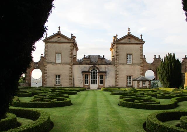
- New Lanark UNESCO World Heritage Site
Day-by-day itinerary
A suggested 3-day schedule. Adjust to your fitness and conditions.
1Glasgow to Bothwell22km · 150m ascent
From Glasgow city centre along the Clyde through the regenerated riverside past the SEC and Dalmarnock to Bothwell with its magnificent castle.
- Terrain
- Urban riverside paths, cycle paths, parkland. Flat and surfaced.
- Overnight
- Bothwell has hotels and B&Bs. Hamilton is nearby with more options.
- Stats
- Glasgow → Bothwell · 22km · ↑150m
2Bothwell to Crossford22km · 200m ascent
Past Bothwell Castle and through Lanarkshire farmland along the Clyde. The landscape becomes increasingly rural as you leave Greater Glasgow behind.
- Terrain
- Riverside paths, farm tracks, woodland trails.
- Overnight
- Crossford has the Tillietudlem Hotel and B&Bs. Lanark is 3km away with more choice.
- Stats
- Bothwell → Crossford · 22km · ↑200m
3Crossford to New Lanark21km · 250m ascent
The finest day — through the Clyde gorge past Corra Linn and Bonnington Linn waterfalls to the UNESCO World Heritage Site of New Lanark.
- Terrain
- Gorge paths, woodland trails, some steep sections near the falls.
- Overnight
- New Lanark has the New Lanark Mill Hotel. Lanark above has hotels and B&Bs.
- Stats
- Crossford → New Lanark · 21km · ↑250m
Transport
To start (Glasgow)
Train · ScotRail
Partick station (Argyle / North Clyde lines) at the western trailhead
Check times & book →
From finish (New Lanark)
Train · ScotRail
Lanark station (1.5 miles uphill from New Lanark), hourly to Glasgow Central
Check times & book →
Best months
Accommodation
Glasgow has everything. Hamilton and Lanark have hotels and B&Bs. New Lanark has its own hotel. Glasgow has unlimited accommodation; Hamilton, Bothwell and Lanark have hotels and B&Bs. The route is rideable so day-trip logistics work via ScotRail.
Night-by-night guide: where to stay →Resupply
Never far from a shop. Fully urban for the first third. Tesco and other supermarkets in Glasgow, Bothwell, Hamilton and Lanark; never more than 8km from resupply, and the route stays urban or suburban for most of its length.
Connect with
Chain into a longer expedition by combining with adjacent long-distance routes.
Current conditions
Weather at the start point (Glasgow)
Daylight Today
- Sunrise
- 05:18
- Sunset
- 21:29
- Civil dawn
- 04:29
- Civil dusk
- 22:18
NOAA Solar Calculator · 30 July 2026
Share your experience
Walked the Clyde Walkway? Help others plan their trip.
Getting to and from the Clyde Walkway
Train and town anchors at each end of the route — on TripSCOT.