Marilyn · Outer Hebrides
Triuirebheinn
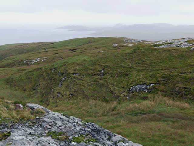
Triuirebheinn — the hill of the three — sits in southern South Uist between Loch Boisdale and the empty east coast glens. Its 357m summit overlooks deserted clearance villages where families once worked the thin soils.
Quick facts
- Height
- 357m/ 1171ft
- Prominence
- 256 m
- Grid ref
- NF 81276 21260
- Dogs
- Dogs on lead required near livestockDog-friendly guide ↗
Height and prominence cross-checked against the Database of British and Irish Hills (CC BY).
No GPX track yet
Walked this route? Share your track to help other walkers.
Standard route
blanket bog 50% · Lewisian gneiss 35% · rocky summit 15%
From the B888 near Loch Boisdale, follow the burn east into Glen Liadale and pick a line up the western flank to the broad summit. Around three to four hours covers the round trip with steady navigation.
Terrain
Hummocky moor laced with peat hags, opening onto a flat summit plateau of cropped grass and bedrock. The going eases noticeably above the 250m contour.
In winter
Hebridean winters here mean horizontal rain and gales rather than snow. Watch for swollen burns on the approach and short midwinter daylight that bites quickly at this latitude.
Best time of year
Getting there
- Glasgow9h 32m
- Edinburgh11h 2m
Ferry access
Mallaig → Lochboisdale (South Uist)
- Crossing time210 min
- Summer sailings1–2 sailings daily (Apr–Oct)
- Winter sailingsReduced sailings on a combined Oban–Castlebay/Lochboisdale winter timetable (Nov–Mar)
- Book ahead14 days
Plan an overnight stay. Alternative: Uig (Skye) → Lochmaddy (North Uist) then drive south across the causeways.
Book on CalMac ↗OS maps: OS Landranger 31, OS Explorer 453S
Mobile signal: Poor. EE absent; bring offline maps for this trackless North Uist hill.
Current conditions
Daylight Today
- Sunrise
- 05:23
- Sunset
- 21:49
- Civil dawn
- 04:30
- Civil dusk
- 22:41
NOAA Solar Calculator · 30 July 2026
Triuirebheinn — common questions
- How difficult is Triuirebheinn?
- Triuirebheinn carries a 1/5 (easy) grade on the OutdoorSCOT scale. Underfoot: Hummocky moor laced with peat hags, opening onto a flat summit plateau of cropped grass and bedrock.
- What is Triuirebheinn's prominence?
- 256m of prominence. That's the vertical drop from the summit to the col that links Triuirebheinn to the next higher ground. That drop is what qualifies it as a Marilyn — a hill with at least 150m of descent on every side.
- When is the best time to climb Triuirebheinn?
- March, April, May, June, July, August, September, October give the most reliable conditions on Triuirebheinn. Beyond that window the high ground turns wintry: carry full mountain kit, be confident navigating, and check the SAIS avalanche forecast for the area.
- Is Triuirebheinn dog-friendly?
- Yes, but dogs must be kept on a lead — there is livestock or ground-nesting bird interest on the route.
- Is there mobile signal on Triuirebheinn?
- Poor. EE absent; bring offline maps for this trackless North Uist hill.
- How do I get the ferry to Triuirebheinn?
- Mallaig → Lochboisdale (South Uist). 1–2 sailings daily (Apr–Oct) in summer; Reduced sailings on a combined Oban–Castlebay/Lochboisdale winter timetable (Nov–Mar) in winter. Book at least 14 days ahead. Plan an overnight stay. Alternative: Uig (Skye) → Lochmaddy (North Uist) then drive south across the causeways.
- Is Triuirebheinn safe in winter?
- Hebridean winters here mean horizontal rain and gales rather than snow. Watch for swollen burns on the approach and short midwinter daylight that bites quickly at this latitude.
Get the OutdoorSCOT weekly
One email a week — new route, hill and bothy guides, seasonal conditions and the odd hard-won lesson. No spam, unsubscribe in one click.