Marilyn · Outer Hebrides
Sron an Duin
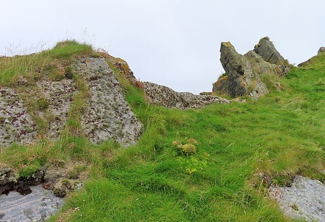
Sron an Duin (the nose of the fort) is the 197m high point of Berneray, the southernmost of the Bishop's Isles south of Barra in the Outer Hebrides (NL 54868 80228). A remote uninhabited island with the Atlantic on three sides, the summit looks out to the Skerryvore lighthouse and across to Mingulay and Pabbay.
Quick facts
- Height
- 197m/ 646ft
- Prominence
- 197 m
- Grid ref
- NL 54868 80228
- Dogs
- Dogs on lead required near livestockDog-friendly guide ↗
Height and prominence cross-checked against the Database of British and Irish Hills (CC BY).
No GPX track yet
Walked this route? Share your track to help other walkers.
Standard route
rough grassland 50% · rocky ground 30% · heather 20%
Reached only by chartered boat from Castlebay or Mingulay landings, weather permitting. From the usual landing place at the bay, climb pathless grass and rock slopes to the 197m summit. Allow 2-3 hours on the island.
Terrain
Hebridean maritime grass, rocky outcrops and bird-burrowed turf on a steep-sided uninhabited island. Cliffs around much of the perimeter — keep well back from edges. No tracks.
In winter
Winter visits are effectively impossible — boat operators do not run, and Atlantic gales lash the island. Summer-only objective in settled weather.
Best time of year
Getting there
- Glasgow9h 8m
- Edinburgh12h 45m
OS maps: OS Landranger 31, OS Explorer 452S
Mobile signal: Poor. South Uist/Barra area; limited coverage.
Current conditions
Daylight Today
- Sunrise
- 05:26
- Sunset
- 21:48
- Civil dawn
- 04:35
- Civil dusk
- 22:39
NOAA Solar Calculator · 30 July 2026
Sron an Duin — common questions
- How hard is Sron an Duin?
- We grade Sron an Duin at 2/5, which puts it in moderate territory. Ground conditions: Hebridean maritime grass, rocky outcrops and bird-burrowed turf on a steep-sided uninhabited island.
- How much drop does Sron an Duin have?
- Sron an Duin's prominence is its full height — 197m — because it is the highest point of its landmass, with no higher ground connected to it. Passing the 150m-drop threshold on all sides is exactly what makes it a Marilyn.
- What's the best month to climb Sron an Duin?
- Aim for March, April, May, June, July, August, September, October on Sron an Duin. In the remaining months treat it as a winter hill — full kit, solid navigation, and a look at the relevant SAIS avalanche forecast before you go.
- Can dogs go up Sron an Duin?
- Dogs are fine on a lead. The route passes livestock or ground-nesting bird habitat, so keep them close throughout.
- Will I get phone signal on Sron an Duin?
- Poor. South Uist/Barra area; limited coverage.
- Is Sron an Duin safe in winter?
- Winter visits are effectively impossible — boat operators do not run, and Atlantic gales lash the island. Summer-only objective in settled weather.
Get the OutdoorSCOT weekly
One email a week — new route, hill and bothy guides, seasonal conditions and the odd hard-won lesson. No spam, unsubscribe in one click.