Marilyn · Skye & The Small Isles
Mullach na Carn
Mullach na Carn is a quiet 396m top on the Isle of Scalpay, just off the east coast of Skye, requiring boat or low-tide crossing to reach. Few walkers visit, making the summit a genuinely solitary experience.
Quick facts
- Height
- 396m/ 1299ft
- Prominence
- 396 m
- Grid ref
- NG 60582 29231
- Dogs
- Dogs on lead required near livestockDog-friendly guide ↗
Height and prominence cross-checked against the Database of British and Irish Hills (CC BY).
No GPX track yet
Walked this route? Share your track to help other walkers.
Standard route
heather moorland 55% · rocky slopes 30% · grass slopes 15%
Access is the crux — usually a wade or a friendly boat from Skye at low tide. Once ashore, a pathless climb through deer-grazed grass and birchwood gains the summit. About 6 km of walking on the island.
Terrain
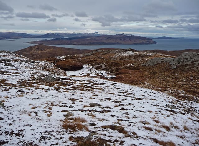
Mix of birch and hazel woodland on the lower slopes, then rough heather and rock platforms higher up. Deer paths help with navigation.
In winter
Tides and weather make Scalpay tricky in winter. Plan crossings carefully and allow margin for storm-bound returns to the mainland.
Best time of year
Getting there
- Glasgow6h 48m
- Edinburgh8h 0m
OS maps: OS Landranger 32, OS Explorer 409, OS Explorer 411
Mobile signal: Poor. Remote Inner Hebrides; limited coverage.
Current conditions
Daylight Today
- Sunrise
- 06:52
- Sunset
- 19:48
- Civil dawn
- 06:13
- Civil dusk
- 20:27
NOAA Solar Calculator · 14 September 2026
Around Mullach na Carn on the SCOT network
Getting there, basing yourself, and what to do off the hill.
Getting there: Kyle of Lochalsh station
Skye Bridge; Five Sisters of Kintail; Glen Shiel; Plockton
16km from the hill
tripscot.co.uk
On TripSCOTBase yourself in Applecross
Bealach na Bà and the Applecross peninsula
18km from the hill
tripscot.co.uk
On TasteSCOTAfter the hill: Isle of Raasay Distillery
Raasay — new island distillery with rooms; Dun Caan walks from the door
10km from the hill
tastescot.co.uk
Mullach na Carn — common questions
- Is Mullach na Carn a hard climb?
- Mullach na Carn is rated 1/5 (easy) on the OutdoorSCOT scale. Terrain: Mix of birch and hazel woodland on the lower slopes, then rough heather and rock platforms higher up.
- How prominent is Mullach na Carn?
- Mullach na Carn's prominence is its full height — 396m — because it is the highest point of its landmass, with no higher ground connected to it. Marilyns are defined by that measure: at least 150m of drop on all sides.
- When should I climb Mullach na Carn?
- The standard good-weather months for Mullach na Carn are March, April, May, June, July, August, September, October. Outside those months, expect winter conditions on the high ground — full mountain kit, navigation skills, and a check of the SAIS avalanche forecast for the relevant region.
- Can I bring my dog up Mullach na Carn?
- On a lead only — the route crosses ground with livestock or nesting-bird interest.
- What's mobile reception like on Mullach na Carn?
- Poor. Remote Inner Hebrides; limited coverage.
- Is Mullach na Carn safe in winter?
- Tides and weather make Scalpay tricky in winter. Plan crossings carefully and allow margin for storm-bound returns to the mainland.
Get the OutdoorSCOT weekly
One email a week — new route, hill and bothy guides, seasonal conditions and the odd hard-won lesson. No spam, unsubscribe in one click.