Sub-Marilyn · Borders
Mountbenger Law
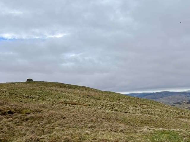
A 543m grassy summit above Mountbenger farm in the Yarrow valley, an area immortalised by James Hogg the Ettrick Shepherd. The hill rises gently from the Yarrow Water with views across to Deuchar Law.
Quick facts
- Height
- 543.9m/ 1784ft
- Prominence
- 145 m
- Grid ref
- NT 31201 27566
- Parking
- NT 32500 25000
- Nearest city
- Edinburgh· 47km
- Dogs
- Dogs on lead required near livestockDog-friendly guide ↗
Sub-Marilyn: 145m of drop — misses the 150m Marilyn cut by 5m. We keep it on the list as a near-miss.
Height and prominence cross-checked against the Database of British and Irish Hills (CC BY).
No GPX track yet
Walked this route? Share your track to help other walkers.
Standard route
grass moorland 65% · heather 25% · boggy ground 10%
From the B709 near Mountbenger, a direct grassy line climbs the western flank in 2-3 hours return. The hill pairs naturally with neighbouring Deuchar Law.
Terrain
Sheep pasture giving way to short upland grass on the summit dome. Generally dry going with a few wet hollows on the approach.
In winter
Modest height and southerly aspect make this an accessible winter option. Frost-firmed ground often gives the best walking.
Best time of year
Getting there
- Glasgow3h 6m
- Edinburgh1h 5m
OS maps: OS Landranger 73, OS Explorer 337
Mobile signal: Good. Scottish Borders/Yarrow; EE reliable.
Current conditions
Daylight Today
- Sunrise
- 05:15
- Sunset
- 21:23
- Civil dawn
- 04:26
- Civil dusk
- 22:11
NOAA Solar Calculator · 30 July 2026
Around Mountbenger Law on the SCOT network
Getting there, basing yourself, and what to do off the hill.
Mountbenger Law — common questions
- Is Mountbenger Law a hard climb?
- Mountbenger Law is rated 2/5 (moderate) on the OutdoorSCOT scale. Ground conditions: Sheep pasture giving way to short upland grass on the summit dome.
- How much drop does Mountbenger Law have?
- The drop is 145m: measured from the summit of Mountbenger Law down to the saddle joining it to higher terrain. That leaves it 5m short of the 150m drop a Marilyn needs — DoBIH classes it a sub-Marilyn, a near-miss rather than a full Marilyn.
- Where's the parking for Mountbenger Law?
- Park at NT 32500 25000. Double-check the grid reference on an OS map first; informal laybys here fill early in high season.
- What's the best month to climb Mountbenger Law?
- Aim for most of the year on Mountbenger Law. In the remaining months treat it as a winter hill — full kit, solid navigation, and a look at the relevant SAIS avalanche forecast before you go.
- Can dogs go up Mountbenger Law?
- Dogs are fine on a lead. The route passes livestock or ground-nesting bird habitat, so keep them close throughout.
- Will I get phone signal on Mountbenger Law?
- Good. Scottish Borders/Yarrow; EE reliable.
- Is Mountbenger Law safe in winter?
- Modest height and southerly aspect make this an accessible winter option. Frost-firmed ground often gives the best walking.
Get the OutdoorSCOT weekly
One email a week — new route, hill and bothy guides, seasonal conditions and the odd hard-won lesson. No spam, unsubscribe in one click.