Marilyn · Galloway
Dungavel Hill
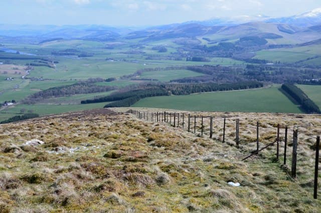
Dungavel Hill rises at NS94 above the village of Coalburn in South Lanarkshire, a 510m moorland summit overlooking the Douglas valley and the M74 corridor. The wind farms dotting its flanks underline its position on a windswept high plateau.
Quick facts
- Height
- 510m/ 1673ft
- Prominence
- 222 m
- Grid ref
- NS 94282 30555
- Parking
- NS 939 318
- Nearest city
- Glasgow· 49km
- Dogs
- Dogs on lead required near livestockDog-friendly guide ↗
Height and prominence cross-checked against the Database of British and Irish Hills (CC BY).
No GPX track yet
Walked this route? Share your track to help other walkers.
Standard route
heather moorland 55% · grass slopes 35% · rocky summit 10%
Start from the access road for Dungavel Wind Farm and follow the wide service tracks south onto the high moor. Leave the tracks for a short pathless walk over heather to the summit cairn.
Terrain
Hard-surfaced wind-farm roads ease most of the approach. The final summit section crosses tussocky heather and short peat hags.
In winter
Wind-farm tracks remain plough-cleared in winter for service access, making this a surprisingly reliable cold-weather objective. Watch for fast-moving rime ice on the turbines.
Best time of year
Getting there
- Glasgow2h 40m
- Edinburgh2h 37m
OS maps: OS Landranger 71, OS Landranger 72, OS Explorer 335
Mobile signal: Good. East Ayrshire; EE reliable on summit — download offline maps as backup.
Current conditions
Daylight Today
- Sunrise
- 05:17
- Sunset
- 21:26
- Civil dawn
- 04:28
- Civil dusk
- 22:14
NOAA Solar Calculator · 30 July 2026
Around Dungavel Hill on the SCOT network
Getting there, basing yourself, and what to do off the hill.
Dungavel Hill — common questions
- How difficult is Dungavel Hill?
- Dungavel Hill carries a 2/5 (moderate) grade on the OutdoorSCOT scale. Underfoot: Hard-surfaced wind-farm roads ease most of the approach.
- What is Dungavel Hill's prominence?
- 222m of prominence. That's the vertical drop from the summit to the col that links Dungavel Hill to the next higher ground. That drop is what qualifies it as a Marilyn — a hill with at least 150m of descent on every side.
- Where do I park for Dungavel Hill?
- Most walkers start from NS 939 318. Verify the grid reference on an OS map before you set off — space is tight on busy summer weekends.
- When is the best time to climb Dungavel Hill?
- March, April, May, June, July, August, September, October give the most reliable conditions on Dungavel Hill. Beyond that window the high ground turns wintry: carry full mountain kit, be confident navigating, and check the SAIS avalanche forecast for the area.
- Is Dungavel Hill dog-friendly?
- Yes, but dogs must be kept on a lead — there is livestock or ground-nesting bird interest on the route.
- Is there mobile signal on Dungavel Hill?
- Good. East Ayrshire; EE reliable on summit — download offline maps as backup.
- Is Dungavel Hill safe in winter?
- Wind-farm tracks remain plough-cleared in winter for service access, making this a surprisingly reliable cold-weather objective. Watch for fast-moving rime ice on the turbines.
Get the OutdoorSCOT weekly
One email a week — new route, hill and bothy guides, seasonal conditions and the odd hard-won lesson. No spam, unsubscribe in one click.