Marilyn · Argyll & Bute
Carn Breugach
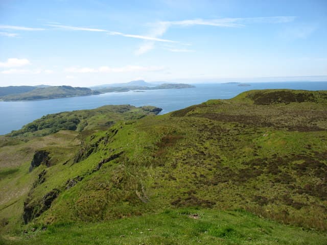
Carn Breugach, the False Cairn, is the high point of the island of Kerrera off Oban at 189m. Combine it with the popular Kerrera circuit and you have one of the most enjoyable low-level days on the west coast.
Quick facts
- Height
- 189m/ 620ft
- Prominence
- 189 m
- Grid ref
- NM 81508 27814
- Nearest city
- Oban· 5km
- Dogs
- Dogs on lead required near livestockDog-friendly guide ↗
Height and prominence cross-checked against the Database of British and Irish Hills (CC BY).
No GPX track yet
Walked this route? Share your track to help other walkers.
Standard route
heather and bog 65% · grass slopes 25% · rocky summit 10%
Catch the small passenger ferry from Gallanach to Kerrera, then follow the island circular track before turning inland on a rough path to the cairn. Around three hours including the ferry crossings.
Terrain
Surfaced island tracks meet a faint hill path through bracken and bog myrtle to the rocky top. Sheep keep the grass short on the upper slopes.
In winter
Snow is rare on this exposed sea-girt summit but salt-laden gales can stop ferry sailings. Check the timetable before setting out.
Best time of year
Getting there
- Glasgow4h 37m
- Edinburgh6h 11m
OS maps: OS Landranger 49, OS Explorer 359
Mobile signal: Poor. A blackspot on every network; bring paper maps for this remote Argyll walk.
Current conditions
Daylight Today
- Sunrise
- 06:51
- Sunset
- 19:45
- Civil dawn
- 06:13
- Civil dusk
- 20:23
NOAA Solar Calculator · 14 September 2026
Around Carn Breugach on the SCOT network
Getting there, basing yourself, and what to do off the hill.
Carn Breugach — common questions
- What difficulty is Carn Breugach?
- On the OutdoorSCOT scale, Carn Breugach comes in at 1/5 — easy. Ground conditions: Surfaced island tracks meet a faint hill path through bracken and bog myrtle to the rocky top.
- How much drop does Carn Breugach have?
- Carn Breugach's prominence is its full height — 189m — because it is the highest point of its landmass, with no higher ground connected to it. Passing the 150m-drop threshold on all sides is exactly what makes it a Marilyn.
- What's the best month to climb Carn Breugach?
- Aim for March, April, May, June, July, August, September, October on Carn Breugach. In the remaining months treat it as a winter hill — full kit, solid navigation, and a look at the relevant SAIS avalanche forecast before you go.
- Can dogs go up Carn Breugach?
- Dogs are fine on a lead. The route passes livestock or ground-nesting bird habitat, so keep them close throughout.
- Will I get phone signal on Carn Breugach?
- Poor. A blackspot on every network; bring paper maps for this remote Argyll walk.
- Is Carn Breugach safe in winter?
- Snow is rare on this exposed sea-girt summit but salt-laden gales can stop ferry sailings. Check the timetable before setting out.
Get the OutdoorSCOT weekly
One email a week — new route, hill and bothy guides, seasonal conditions and the odd hard-won lesson. No spam, unsubscribe in one click.