Marilyn · Kintail
Beinn Dubh an Iaruinn
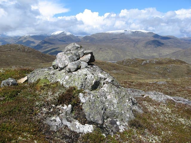
Beinn Dubh an Iaruinn — the black hill of the iron — rises to 591m at NH 182 392 in the high ground between Strathconon and Glen Carron. The name probably points to ironstone or iron-rich rock once worked or noted in the area; the eastern face does show rust-stained outcrops.
Gaelic: “mountain, black, the” · Pronunciation: bine doo an iaruinn
Quick facts
- Height
- 591m/ 1939ft
- Prominence
- 240 m
- Grid ref
- NH 18234 39214
- Nearest city
- Inverness· 49km
- Dogs
- Dogs on lead required near livestockDog-friendly guide ↗
Height and prominence cross-checked against the Database of British and Irish Hills (CC BY).
No GPX track yet
Walked this route? Share your track to help other walkers.
Standard route
heather moorland 55% · rocky slopes 30% · grass slopes 15%
Approach from the Strathconon road at Inverchoran or Scardroy. The estate track gives easy initial progress before pathless heather leads onto the broad northern shoulder and so to the summit cairn. Around 5 hours all-in.
Terrain
Vehicle track for the lower section, then a long stretch of heathery slopes with peat hags on the broad northern shoulder. The summit area is firmer with patches of moss campion and ironstone outcrops.
In winter
Snow can pile up on the lee eastern face after westerly storms while the western approach lies bare. The featureless top is the trap — careful pacing and bearings are essential when cloud is on.
Best time of year
Getting there
- Glasgow4h 29m
- Edinburgh6h 4m
OS maps: OS Landranger 25, OS Explorer 430
Mobile signal: Poor. Signal absent throughout; remote Ross-shire glen has no coverage.
Current conditions
Daylight Today
- Sunrise
- 05:12
- Sunset
- 21:41
- Civil dawn
- 04:19
- Civil dusk
- 22:34
NOAA Solar Calculator · 30 July 2026
Around Beinn Dubh an Iaruinn on the SCOT network
Getting there, basing yourself, and what to do off the hill.
Beinn Dubh an Iaruinn — common questions
- Is Beinn Dubh an Iaruinn a hard climb?
- Beinn Dubh an Iaruinn is rated 2/5 (moderate) on the OutdoorSCOT scale. Ground conditions: Vehicle track for the lower section, then a long stretch of heathery slopes with peat hags on the broad northern shoulder.
- How much drop does Beinn Dubh an Iaruinn have?
- The drop is 240m: measured from the summit of Beinn Dubh an Iaruinn down to the saddle joining it to higher terrain. Passing the 150m-drop threshold on all sides is exactly what makes it a Marilyn.
- What's the best month to climb Beinn Dubh an Iaruinn?
- Aim for March, April, May, June, July, August, September, October on Beinn Dubh an Iaruinn. In the remaining months treat it as a winter hill — full kit, solid navigation, and a look at the relevant SAIS avalanche forecast before you go.
- Can dogs go up Beinn Dubh an Iaruinn?
- Dogs are fine on a lead. The route passes livestock or ground-nesting bird habitat, so keep them close throughout.
- Will I get phone signal on Beinn Dubh an Iaruinn?
- Poor. Signal absent throughout; remote Ross-shire glen has no coverage.
- Is Beinn Dubh an Iaruinn safe in winter?
- Snow can pile up on the lee eastern face after westerly storms while the western approach lies bare. The featureless top is the trap — careful pacing and bearings are essential when cloud is on.
Get the OutdoorSCOT weekly
One email a week — new route, hill and bothy guides, seasonal conditions and the odd hard-won lesson. No spam, unsubscribe in one click.