Marilyn · Torridon
An Cuaidh
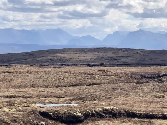
An Cuaidh — possibly the cup, from cuach — reaches 296m at NG 765 891 on the Rubha Mor peninsula north of Mellon Charles. The name may refer to a small cup-shaped corrie on its northern face, where the only steeper ground breaks the otherwise rolling moor.
Quick facts
- Height
- 296m/ 971ft
- Prominence
- 161 m
- Grid ref
- NG 76503 89114
- Nearest city
- Inverness· 100km
- Dogs
- Dogs on lead required near livestockDog-friendly guide ↗
Height and prominence cross-checked against the Database of British and Irish Hills (CC BY).
No GPX track yet
Walked this route? Share your track to help other walkers.
Standard route
heather moorland 55% · rocky slopes 30% · grass slopes 15%
Start near Mellon Charles and follow a faint path north onto open ground. The summit is a short rise from the surrounding moorland. Around 2-3 hours including the lochan-strewn approach.
Terrain
Sodden coastal moor laced with small lochans and gneiss knolls. Picking dry lines between the wet bits is the chief route-finding skill; no underfoot challenge above that.
In winter
Genuinely sea-edge — snow seldom lies. Gales off the Atlantic are the dominant hazard, with the open ground giving no shelter. A clear, calm winter morning gives one of the finest sea panoramas in the country.
This hill is in the Torridon SAIS forecast area. Check SAIS forecasts in winter (December–April).
Best time of year
Getting there
- Glasgow6h 27m
- Edinburgh8h 16m
OS maps: OS Landranger 19, OS Explorer 434
Mobile signal: Poor. Signal completely absent; consult a paper map and carry an emergency device.
Current conditions
Daylight Today
- Sunrise
- 05:13
- Sunset
- 21:46
- Civil dawn
- 04:18
- Civil dusk
- 22:41
NOAA Solar Calculator · 30 July 2026
Around An Cuaidh on the SCOT network
Getting there, basing yourself, and what to do off the hill.
An Cuaidh — common questions
- What difficulty is An Cuaidh?
- On the OutdoorSCOT scale, An Cuaidh comes in at 1/5 — easy. Underfoot: Sodden coastal moor laced with small lochans and gneiss knolls.
- What is An Cuaidh's prominence?
- 161m of prominence. That's the vertical drop from the summit to the col that links An Cuaidh to the next higher ground. That drop is what qualifies it as a Marilyn — a hill with at least 150m of descent on every side.
- When is the best time to climb An Cuaidh?
- March, April, May, June, July, August, September, October give the most reliable conditions on An Cuaidh. Beyond that window the high ground turns wintry: carry full mountain kit, be confident navigating, and check the SAIS avalanche forecast for the area.
- Is An Cuaidh dog-friendly?
- Yes, but dogs must be kept on a lead — there is livestock or ground-nesting bird interest on the route.
- Is there mobile signal on An Cuaidh?
- Poor. Signal completely absent; consult a paper map and carry an emergency device.
- Is An Cuaidh safe in winter?
- Genuinely sea-edge — snow seldom lies. Gales off the Atlantic are the dominant hazard, with the open ground giving no shelter. A clear, calm winter morning gives one of the finest sea panoramas in the country.
Get the OutdoorSCOT weekly
One email a week — new route, hill and bothy guides, seasonal conditions and the odd hard-won lesson. No spam, unsubscribe in one click.