Corbett · Outer Hebrides
An Cliseam (Clisham)
An Cliseam — the Clisham, in its more familiar English form — is the highest hill in the Outer Hebrides and the only Corbett-class summit in the islands. At 800m it stands as the high point of the North Harris hills and, with a full 800m of prominence (the entire height above sea-level), it ranks among the most prominent hills in Britain — the unobstructed view stretches from St Kilda in the west to the entire mainland Highlands in the east, with the Minch sea separating the two.
Quick facts
- Height
- 800m/ 2625ft
- Prominence
- 800 m
- Distance
- 14 km
- Ascent
- 656 m
- Time
- 5–8 hrs
- Grid ref
- NB154073
- Parking
- NB126065
- Nearest
- Ullapool
- Dogs
- Dogs on lead required near livestockDog-friendly guide ↗
Height and prominence cross-checked against the Database of British and Irish Hills (CC BY).
No GPX track yet
Walked this route? Share your track to help other walkers.
Standard route
boggy path 25% · gneiss slopes 30% · connecting ridge 35% · summit cairn 10%
The popular line begins at the lay-by on the A859 near Bunavoneadar / Maaruig and follows the boggy path west-south-west onto Mulla bho Dheas, then traverses the ridge to An Cliseam over Mulla bho Thuath. Around 14km return with 656m of ascent. A shorter direct ascent climbs the east shoulder from a lay-by further north on the A859. Bring a ferry to Harris from Skye or Ullapool to get there.
Terrain
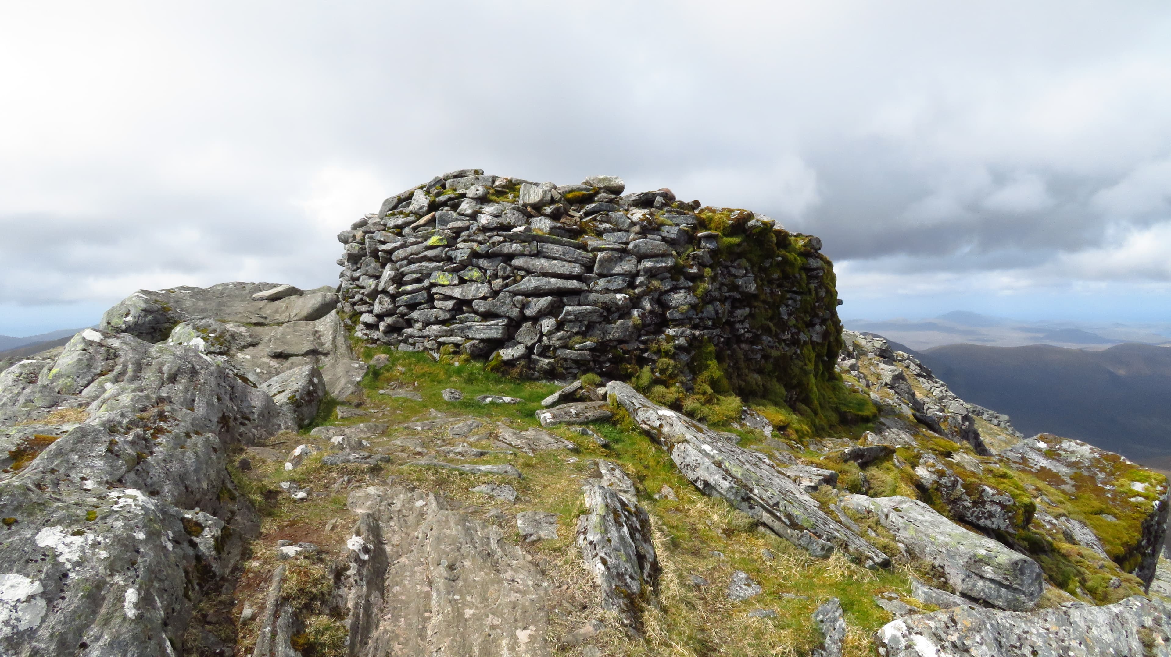
Lower ground around the lay-bys is wet peat and bog with intermittent paths. The Lewisian gneiss of the upper hill is firm and grippy when dry, slippery when wet. The summit area is rocky with the cairn unmistakable. The ridge between Mulla bho Dheas and the summit is broad short grass and rock with no exposure.
In winter
Snow cover on Harris is intermittent — full winter conditions rare but the Atlantic gales make wind chill brutal even at modest altitudes. The A859 is gritted; ferry services to the islands may be cancelled in storm conditions and isolate the hill for days at a time. Plan around ferry timetables and weather windows carefully.
Best time of year
Getting there
- Glasgow5h 24m
- Edinburgh6h 2m
Ferry access
Uig (Skye) → Tarbert (Harris)
- Crossing time105 min
- Summer sailings2 sailings daily (Apr–Oct)
- Winter sailings1 sailing daily (Nov–Mar)
- Book ahead14 days
- Last ferry backCheck CalMac timetable — last sailing to Uig varies seasonally
Drive to Uig on Skye (Skye Bridge from Kyle of Lochalsh), then ferry to Harris. Alternative: Ullapool → Stornoway (Lewis, 2h45) and drive south.
Book on CalMac ↗OS maps: OS Landranger 13, OS Landranger 14
Mobile signal: Good signal for Harris — 2-3 bars on and around the summit
Current conditions
Daylight Today
- Sunrise
- 04:45
- Sunset
- 22:21
- Civil dawn
- 03:39
- Civil dusk
- 23:27
NOAA Solar Calculator · 13 July 2026
Pair with
Curated multi-hill combinations from An Cliseam (Clisham).
Around An Cliseam (Clisham) on the SCOT network
Getting there, basing yourself, and what to do off the hill.
An Cliseam (Clisham) — common questions
- What difficulty is An Cliseam (Clisham)?
- On the OutdoorSCOT scale, An Cliseam (Clisham) comes in at 2/5 — moderate. Expect roughly 14km and 656m of ascent on the usual route — 5-8 hours for most parties. Terrain: Lower ground around the lay-bys is wet peat and bog with intermittent paths.
- How prominent is An Cliseam (Clisham)?
- An Cliseam (Clisham)'s prominence is its full height — 800m — because it is the highest point of its landmass, with no higher ground connected to it.
- Where should I park to climb An Cliseam (Clisham)?
- Standard parking is at NB126065 near Ullapool. Check the parking grid reference on an OS map before travel; informal laybys can fill on summer weekends.
- When should I climb An Cliseam (Clisham)?
- The standard good-weather months for An Cliseam (Clisham) are May, June, July, August, September. Outside those months, expect winter conditions on the high ground — full mountain kit, navigation skills, and a check of the SAIS avalanche forecast for the relevant region.
- Can I bring my dog up An Cliseam (Clisham)?
- On a lead only — the route crosses ground with livestock or nesting-bird interest.
- What's mobile reception like on An Cliseam (Clisham)?
- Good signal for Harris — 2-3 bars on and around the summit
- How do I get the ferry to An Cliseam (Clisham)?
- Uig (Skye) → Tarbert (Harris). 2 sailings daily (Apr–Oct) in summer; 1 sailing daily (Nov–Mar) in winter. Book at least 14 days ahead. Drive to Uig on Skye (Skye Bridge from Kyle of Lochalsh), then ferry to Harris. Alternative: Ullapool → Stornoway (Lewis, 2h45) and drive south.
- Is An Cliseam (Clisham) safe in winter?
- Snow cover on Harris is intermittent — full winter conditions rare but the Atlantic gales make wind chill brutal even at modest altitudes. The A859 is gritted; ferry services to the islands may be cancelled in storm conditions and isolate the hill for days at a time. Plan around ferry timetables and weather windows carefully.
Get the OutdoorSCOT weekly
One email a week — new route, hill and bothy guides, seasonal conditions and the odd hard-won lesson. No spam, unsubscribe in one click.