Marilyn · Glen Coe & Lochaber
Beinn Chlaonleud
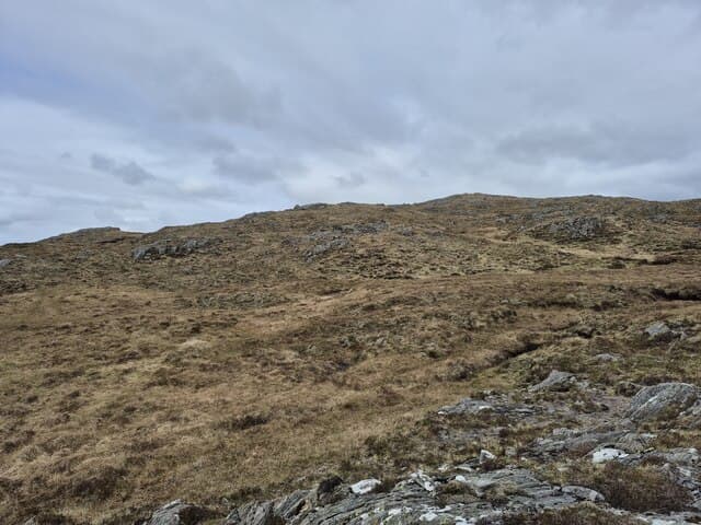
Beinn Chlaonleud, the Slanting Slope Hill, rises to 479m on the rugged Morvern peninsula. Its asymmetric ridge — gentler on one flank, steeper on the other — gives it real character among the lesser-known Ardgour Marilyns.
Quick facts
- Height
- 479m/ 1572ft
- Prominence
- 273 m
- Grid ref
- NM 74822 54282
- Nearest city
- Oban· 27km
- Dogs
- Dogs on lead required near livestockDog-friendly guide ↗
Height and prominence cross-checked against the Database of British and Irish Hills (CC BY).
No GPX track yet
Walked this route? Share your track to help other walkers.
Standard route
heather and bog 60% · rocky slopes 25% · grass slopes 15%
Park off the A884 south of Acharn and tackle the heathery west flank direct to the summit. Expect tussocky going underfoot with no continuous path; navigation skill helps in mist. Plan on roughly 3 to 4 hours return.
Terrain
Wet heather and bog dominate the lower flanks, with rocky outcrops studding the slanting upper slope. The asymmetric profile means one approach is markedly steeper than the other.
In winter
Snow lies briefly on this low Morvern hill but Atlantic gales and freezing rain are the main winter hazards. Visibility can collapse fast; carry full waterproofs and a reliable compass bearing.
This hill is in the Glen Coe SAIS forecast area. Check SAIS forecasts in winter (December–April).
Best time of year
Getting there
- Glasgow4h 11m
- Edinburgh7h 39m
OS maps: OS Landranger 49, OS Explorer 383E, OS Explorer 383W
Mobile signal: Poor. A blanket dead zone on this Ardgour summit.
Current conditions
Daylight Today
- Sunrise
- 05:19
- Sunset
- 21:39
- Civil dawn
- 04:28
- Civil dusk
- 22:30
NOAA Solar Calculator · 30 July 2026
Around Beinn Chlaonleud on the SCOT network
Getting there, basing yourself, and what to do off the hill.
Getting there: Oban station
Argyll ferry hub; Mull, Lismore, Coll, Tiree, Barra connections
27km from the hill
tripscot.co.uk
On TripSCOTBase yourself in Tobermory
Mull base — Ben More, Treshnish, ferry to Iona
24km from the hill
tripscot.co.uk
On TasteSCOTAfter the hill: Tobermory
Mull — colourful harbour-front distillery making both unpeated and peated (Ledaig) whisky
24km from the hill
tastescot.co.uk
Beinn Chlaonleud — common questions
- How difficult is Beinn Chlaonleud?
- Beinn Chlaonleud carries a 1/5 (easy) grade on the OutdoorSCOT scale. Ground conditions: Wet heather and bog dominate the lower flanks, with rocky outcrops studding the slanting upper slope.
- How much drop does Beinn Chlaonleud have?
- The drop is 273m: measured from the summit of Beinn Chlaonleud down to the saddle joining it to higher terrain. Passing the 150m-drop threshold on all sides is exactly what makes it a Marilyn.
- What's the best month to climb Beinn Chlaonleud?
- Aim for March, April, May, June, July, August, September, October on Beinn Chlaonleud. In the remaining months treat it as a winter hill — full kit, solid navigation, and a look at the relevant SAIS avalanche forecast before you go.
- Can dogs go up Beinn Chlaonleud?
- Dogs are fine on a lead. The route passes livestock or ground-nesting bird habitat, so keep them close throughout.
- Will I get phone signal on Beinn Chlaonleud?
- Poor. A blanket dead zone on this Ardgour summit.
- Is Beinn Chlaonleud safe in winter?
- Snow lies briefly on this low Morvern hill but Atlantic gales and freezing rain are the main winter hazards. Visibility can collapse fast; carry full waterproofs and a reliable compass bearing.
Get the OutdoorSCOT weekly
One email a week — new route, hill and bothy guides, seasonal conditions and the odd hard-won lesson. No spam, unsubscribe in one click.