Long distance
Arran Coastal Way
A circular route around the entire coast of Arran — Scotland in miniature. Highland peaks in the north, gentle farmland in the south, beaches, castles and a distillery. Around 105 km (65 mi) point-to-point and 2,400 m up; allow 6 days. Signed throughout.
Quick facts
- Distance
- 105 km/ 65 mi
- Typical days
- 6
- Total ascent
- 2400 m
- Difficulty
- moderate
- Start → Finish
- Brodick → Brodick
- Best direction
- Either direction
- Water sources
- Brodick, Lamlash, Whiting Bay, Kildonan, Blackwaterfoot, Lochranza, Sannox — all have taps, shops and cafes. The route stays close to coastal habitation throughout. Never more than 5km from a fill point.
- Mobile signal
- EE/Vodafone strong throughout — Arran has continuous mobile coverage along the coast. The brief inland sections (Kildonan to Blackwaterfoot, Lochranza glen) may drop signal briefly.
✔ Waymarked throughout
Approximate profile derived from per-stage ascent — accurate on total climb and pattern, not a pixel-precise GPX trace.
Our take
Arran is often called Scotland in miniature and the Coastal Way proves it — granite peaks in the north, palm trees in the south, and everything in between. The northern section between Lochranza and Sannox is the toughest, with genuine coastal scrambling. The south is gentle and pastoral. CalMac ferry from Ardrossan makes access easy. The circular format means you start and finish at the ferry terminal.
Highlights
- Goatfell views from the coast
- Lochranza Castle and distillery
- North coast scrambling between Lochranza and Sannox
- Holy Island views from Lamlash Bay
Day-by-day itinerary
A suggested 6-day schedule. Adjust to your fitness and conditions.
1Brodick to Sannox14km · 350m ascent
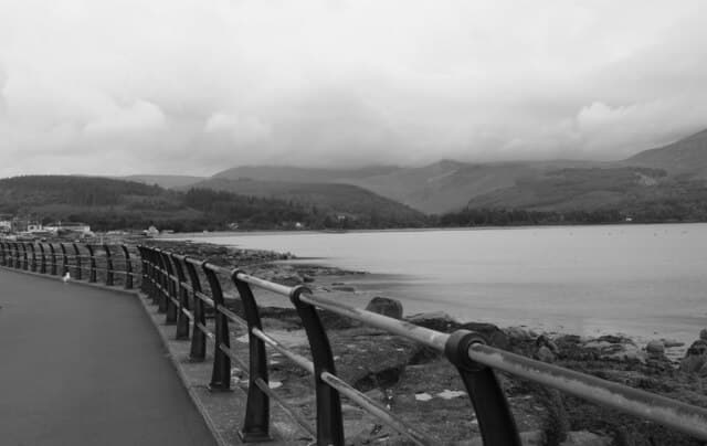
North from Brodick along the coast past Corrie village to Sannox Bay. Goatfell dominates the skyline above. The route blends granite peaks, scrambling sections, raised beaches and sandy bays; the north coast is genuinely rough underfoot while the south is gentle pastoral coast.
- Terrain
- Coastal path, beach sections, quiet road. Moderate terrain.
- Overnight
- Sannox has a campsite. Corrie has the Corrie Hotel. Wild camping at Sannox Bay.
- Stats
- Brodick → Sannox · 14km · ↑350m
2Sannox to Lochranza18km · 550m ascent
The toughest section — around the rugged north coast with rocky scrambling, raised beaches and dramatic cliffs. Allow extra time.
- Terrain
- Rocky coastal scrambling, boulder fields, rough paths. Tidal sections.
- Overnight
- Lochranza has the SYHA hostel, B&Bs and the distillery.
- Stats
- Sannox → Lochranza · 18km · ↑550m
3Lochranza to Blackwaterfoot22km · 400m ascent
Down the wild west coast past Catacol and Pirnmill. Remote beaches and views across to Kintyre. The King's Cave has Pictish carvings.
- Terrain
- Beach walking, coastal paths, some road sections.
- Overnight
- Blackwaterfoot has the Best Western Kinloch Hotel and B&Bs.
- Stats
- Lochranza → Blackwaterfoot · 22km · ↑400m
4Blackwaterfoot to Kildonan20km · 350m ascent
Along the gentle south coast past Lagg and Kildonan Castle. The landscape is softer here — farmland meeting the sea with views to Ailsa Craig.
- Terrain
- Coastal paths, farm tracks, beach walking. Easy terrain.
- Overnight
- Kildonan has the Kildonan Hotel. Lagg has the Lagg Hotel.
- Stats
- Blackwaterfoot → Kildonan · 20km · ↑350m
5Kildonan to Whiting Bay14km · 300m ascent
Past the raised beaches and through farmland to Whiting Bay. Holy Island and its Buddhist retreat are visible across Lamlash Bay.
- Terrain
- Coastal paths, beach sections, quiet lanes.
- Overnight
- Whiting Bay has B&Bs and the Eden Lodge Hotel.
- Stats
- Kildonan → Whiting Bay · 14km · ↑300m
6Whiting Bay to Brodick17km · 450m ascent
The final stretch past Lamlash Bay and Holy Island back to Brodick. Clauchlands Point gives fine views before the ferry terminal finish.
- Terrain
- Coastal paths, woodland trails, some hill walking.
- Overnight
- Brodick has the Douglas Hotel and B&Bs. CalMac ferry to Ardrossan.
- Stats
- Whiting Bay → Brodick · 17km · ↑450m
Transport
To start (Brodick)
Train · ScotRail + CalMac
Glasgow Central to Ardrossan Harbour (ScotRail), then CalMac ferry to Brodick
Hourly trains; ferry several times daily (~55 min)
Trains timed to meet the ferry; station is 2 minutes from the terminal. Some sailings currently route via Troon during fleet repairs.
Check times & book →
From finish (Brodick)
Ferry · CalMac + ScotRail
Brodick to Ardrossan Harbour (CalMac), then ScotRail to Glasgow Central
Hourly trains; multiple daily sailings
Circular route — start = finish at Brodick.
Check times & book →
Best months
Accommodation
Hotels, B&Bs and hostels at Brodick, Lochranza, Blackwaterfoot and Whiting Bay. Book ahead in summer — island accommodation is limited. Hotels, B&Bs and SYHA hostels at Brodick, Lochranza, Blackwaterfoot and Whiting Bay; island accommodation fills early in summer so book three months ahead.
Night-by-night guide: where to stay →Resupply
Brodick has a full Co-op. Smaller shops at Lochranza, Blackwaterfoot and Lamlash. Carry food for the north coast section. Co-op in Brodick and smaller shops at Lochranza, Blackwaterfoot, Lamlash and Whiting Bay; longest gap is the 18km north coast between Sannox and Lochranza — carry food.
Current conditions
Weather at the start point (Brodick)
Daylight Today
- Sunrise
- 05:23
- Sunset
- 21:32
- Civil dawn
- 04:34
- Civil dusk
- 22:20
NOAA Solar Calculator · 30 July 2026
Share your experience
Walked the Arran Coastal Way? Help others plan their trip.
Getting to and from the Arran Coastal Way
Train and town anchors at each end of the route — on TripSCOT.