Marilyn · Outer Hebrides
Sron Romul
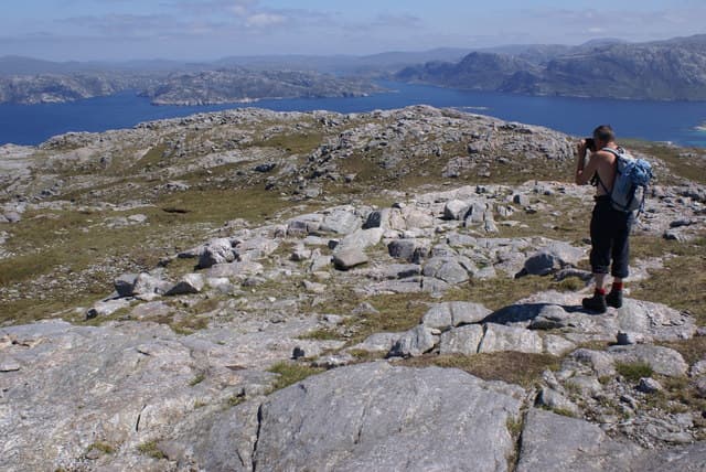
Sron Romul, the nose of Romul, is a remote 308m sea cliff hill on the far west coast of north Harris, looking across the Atlantic toward Mealasta and St Kilda. It is one of the more committing Marilyns thanks to its position in roadless country well beyond Husinish.
Quick facts
- Height
- 308m/ 1010ft
- Prominence
- 308 m
- Grid ref
- NA 96868 15810
- Dogs
- Dogs on lead required near livestockDog-friendly guide ↗
Height and prominence cross-checked against the Database of British and Irish Hills (CC BY).
No GPX track yet
Walked this route? Share your track to help other walkers.
Standard route
blanket bog 50% · Lewisian gneiss 35% · rocky summit 15%
From Husinish, follow the rough path along the coast and across the shoulder of Cnoc na Moine, then descend and climb the headland to the summit. A long day of seven hours plus, with constant boggy walking over peat moor.
Terrain
Wet bog, peat hags and ancient gneiss slabs make for slow walking on the approach. The headland itself drops in cliffs to the Atlantic so care is needed near the summit in wind.
In winter
Truly remote with no shelter; Atlantic storms make this hill dangerous in winter and short daylight rules out a return. Best left until late spring.
Best time of year
Getting there
- Glasgow9h 21m
- Edinburgh12h 33m
Ferry access
Uig (Skye) → Tarbert (Harris)
- Crossing time105 min
- Summer sailings2 sailings daily (Apr–Oct)
- Winter sailings1 sailing daily (Nov–Mar)
- Book ahead14 days
- Last ferry backCheck CalMac timetable — last sailing to Uig varies seasonally
Drive to Uig on Skye (Skye Bridge from Kyle of Lochalsh), then ferry to Harris. Alternative: Ullapool → Stornoway (Lewis, 2h45) and drive south.
Book on CalMac ↗OS maps: OS Landranger 13, OS Explorer 456
Mobile signal: Poor. Blank throughout; North Uist machair and gneiss give no infrastructure.
Current conditions
Daylight Today
- Sunrise
- 05:17
- Sunset
- 21:53
- Civil dawn
- 04:22
- Civil dusk
- 22:48
NOAA Solar Calculator · 30 July 2026
Around Sron Romul on the SCOT network
Getting there, basing yourself, and what to do off the hill.
Sron Romul — common questions
- How difficult is Sron Romul?
- Sron Romul carries a 3/5 (moderately challenging) grade on the OutdoorSCOT scale. Underfoot: Wet bog, peat hags and ancient gneiss slabs make for slow walking on the approach.
- What is Sron Romul's prominence?
- Sron Romul's prominence is its full height — 308m — because it is the highest point of its landmass, with no higher ground connected to it. That drop is what qualifies it as a Marilyn — a hill with at least 150m of descent on every side.
- When is the best time to climb Sron Romul?
- May, June, July, August, September give the most reliable conditions on Sron Romul. Beyond that window the high ground turns wintry: carry full mountain kit, be confident navigating, and check the SAIS avalanche forecast for the area.
- Is Sron Romul dog-friendly?
- Yes, but dogs must be kept on a lead — there is livestock or ground-nesting bird interest on the route.
- Is there mobile signal on Sron Romul?
- Poor. Blank throughout; North Uist machair and gneiss give no infrastructure.
- How do I get the ferry to Sron Romul?
- Uig (Skye) → Tarbert (Harris). 2 sailings daily (Apr–Oct) in summer; 1 sailing daily (Nov–Mar) in winter. Book at least 14 days ahead. Drive to Uig on Skye (Skye Bridge from Kyle of Lochalsh), then ferry to Harris. Alternative: Ullapool → Stornoway (Lewis, 2h45) and drive south.
- Is Sron Romul safe in winter?
- Truly remote with no shelter; Atlantic storms make this hill dangerous in winter and short daylight rules out a return. Best left until late spring.
Get the OutdoorSCOT weekly
One email a week — new route, hill and bothy guides, seasonal conditions and the odd hard-won lesson. No spam, unsubscribe in one click.