Marilyn · Outer Hebrides
Liuthaid
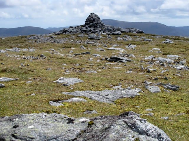
Liuthaid is a 492m gneiss summit deep in the Pairc forest of south Lewis, sitting between Beinn Mhor and the head of Loch Seaforth. Its quiet position makes it one of the least-visited Marilyns in Scotland, with red deer often the only company.
Quick facts
- Height
- 492m/ 1614ft
- Prominence
- 307 m
- Grid ref
- NB 17538 13627
- Dogs
- Dogs on lead required near livestockDog-friendly guide ↗
Height and prominence cross-checked against the Database of British and Irish Hills (CC BY).
No GPX track yet
Walked this route? Share your track to help other walkers.
Standard route
blanket bog 50% · Lewisian gneiss 35% · heather moorland 15%
A demanding 18-22km walk in from the B8060 north of Eishken, weaving between lochans and gneiss knolls. Most groups need 8-9 hours; some use a bike for the early track sections to cut the time.
Terrain
Knock-and-lochan country at its most pronounced — endless small rises, peat hollows and slabby outcrops with no continuous line of advance. Pathless throughout. Stag stalking from August to October.
In winter
A serious winter undertaking due to the distance, short daylight and lack of escape routes. Snow patches linger on north-facing slabs but the main hazard is benightment on rough ground.
Best time of year
Getting there
- Glasgow9h 37m
- Edinburgh11h 44m
Ferry access
Uig (Skye) → Tarbert (Harris)
- Crossing time105 min
- Summer sailings2 sailings daily (Apr–Oct)
- Winter sailings1 sailing daily (Nov–Mar)
- Book ahead14 days
- Last ferry backCheck CalMac timetable — last sailing to Uig varies seasonally
Drive to Uig on Skye (Skye Bridge from Kyle of Lochalsh), then ferry to Harris. Alternative: Ullapool → Stornoway (Lewis, 2h45) and drive south.
Book on CalMac ↗OS maps: OS Landranger 13, OS Landranger 14, OS Explorer 456
Mobile signal: Poor. Signal absent; inform Stornoway coastguard of your plans.
Current conditions
Daylight Today
- Sunrise
- 05:16
- Sunset
- 21:52
- Civil dawn
- 04:21
- Civil dusk
- 22:47
NOAA Solar Calculator · 30 July 2026
Around Liuthaid on the SCOT network
Getting there, basing yourself, and what to do off the hill.
Liuthaid — common questions
- How difficult is Liuthaid?
- Liuthaid carries a 3/5 (moderately challenging) grade on the OutdoorSCOT scale. Ground conditions: Knock-and-lochan country at its most pronounced — endless small rises, peat hollows and slabby outcrops with no continuous line of advance.
- How much drop does Liuthaid have?
- The drop is 307m: measured from the summit of Liuthaid down to the saddle joining it to higher terrain. Passing the 150m-drop threshold on all sides is exactly what makes it a Marilyn.
- What's the best month to climb Liuthaid?
- Aim for April, May, June, July on Liuthaid. In the remaining months treat it as a winter hill — full kit, solid navigation, and a look at the relevant SAIS avalanche forecast before you go.
- Can dogs go up Liuthaid?
- Dogs are fine on a lead. The route passes livestock or ground-nesting bird habitat, so keep them close throughout.
- Will I get phone signal on Liuthaid?
- Poor. Signal absent; inform Stornoway coastguard of your plans.
- How do I get the ferry to Liuthaid?
- Uig (Skye) → Tarbert (Harris). 2 sailings daily (Apr–Oct) in summer; 1 sailing daily (Nov–Mar) in winter. Book at least 14 days ahead. Drive to Uig on Skye (Skye Bridge from Kyle of Lochalsh), then ferry to Harris. Alternative: Ullapool → Stornoway (Lewis, 2h45) and drive south.
- Is Liuthaid safe in winter?
- A serious winter undertaking due to the distance, short daylight and lack of escape routes. Snow patches linger on north-facing slabs but the main hazard is benightment on rough ground.
Get the OutdoorSCOT weekly
One email a week — new route, hill and bothy guides, seasonal conditions and the odd hard-won lesson. No spam, unsubscribe in one click.