Marilyn · Borders
Cademuir Hill
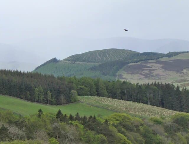
Cademuir Hill is a 415m ridge immediately south-west of Peebles in the Tweed valley (NT 24192 37690). The summit carries the substantial earthworks of an Iron Age hill fort with chevaux-de-frise stones, and offers fine views over Peebles and along Tweeddale toward the Manor Hills.
Quick facts
- Height
- 415.1m/ 1362ft
- Prominence
- 202 m
- Grid ref
- NT 24192 37690
- Nearest city
- Edinburgh· 36km
- Dogs
- Dogs on lead required near livestockDog-friendly guide ↗
Height and prominence cross-checked against the Database of British and Irish Hills (CC BY).
No GPX track yet
Walked this route? Share your track to help other walkers.
Standard route
heather moorland 50% · grass slopes 35% · rocky summit 15%
A popular local walk from Peebles, following the riverside path past Peebles Hydro and Hay Lodge Park then climbing the marked Cademuir track to the 415m summit. About 7km circuit — allow 2-3 hours.
Terrain
Mixed Peeblesshire farmland and rough grazing. Good paths and farm tracks throughout, with short heather sections on the summit ridge.
In winter
Excellent winter half-day from Peebles. Tracks are usable in most conditions; the ridge can be exposed to wind but rarely holds significant snow.
Best time of year
Getting there
- Glasgow3h 46m
- Edinburgh1h 50m
OS maps: OS Landranger 73, OS Explorer 337
Mobile signal: Good. Peeblesshire; solid EE signal on summit and approach.
Current conditions
Daylight Today
- Sunrise
- 05:15
- Sunset
- 21:24
- Civil dawn
- 04:26
- Civil dusk
- 22:13
NOAA Solar Calculator · 30 July 2026
Around Cademuir Hill on the SCOT network
Getting there, basing yourself, and what to do off the hill.
Cademuir Hill — common questions
- What difficulty is Cademuir Hill?
- On the OutdoorSCOT scale, Cademuir Hill comes in at 1/5 — easy. Terrain: Mixed Peeblesshire farmland and rough grazing.
- How prominent is Cademuir Hill?
- Cademuir Hill has 202m of topographic prominence — the height of its summit above the highest col connecting it to higher ground. Marilyns are defined by that measure: at least 150m of drop on all sides.
- When should I climb Cademuir Hill?
- The standard good-weather months for Cademuir Hill are March, April, May, June, July, August, September, October. Outside those months, expect winter conditions on the high ground — full mountain kit, navigation skills, and a check of the SAIS avalanche forecast for the relevant region.
- Can I bring my dog up Cademuir Hill?
- On a lead only — the route crosses ground with livestock or nesting-bird interest.
- What's mobile reception like on Cademuir Hill?
- Good. Peeblesshire; solid EE signal on summit and approach.
- Is Cademuir Hill safe in winter?
- Excellent winter half-day from Peebles. Tracks are usable in most conditions; the ridge can be exposed to wind but rarely holds significant snow.
Get the OutdoorSCOT weekly
One email a week — new route, hill and bothy guides, seasonal conditions and the odd hard-won lesson. No spam, unsubscribe in one click.