Donald · Borders
Windy Gyle
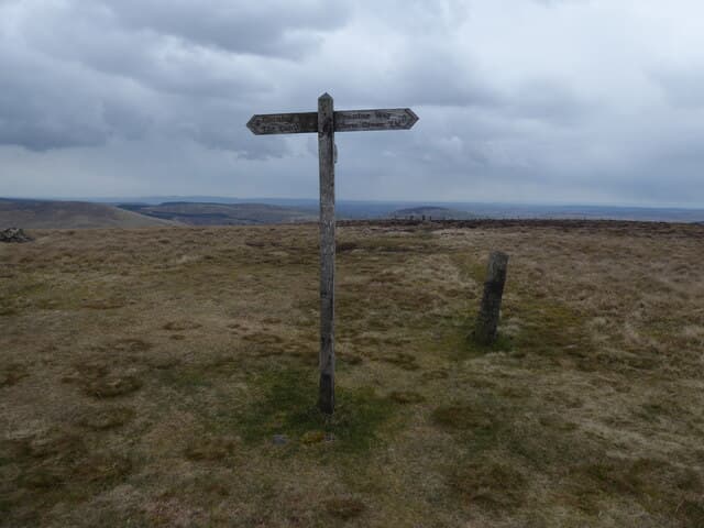
Windy Gyle (619m) straddles the Anglo-Scottish border in the Cheviot Hills, a flat-topped grassy summit named for the relentless wind that scours it. A trig point sits beside the much older Bronze Age cairn of Russell's Cairn, marking both the watershed and the historic march between Northumberland and the Borders. The Pennine Way crosses the top — this is one of the windiest, most exposed sections of that long path.
Quick facts
- Height
- 619m/ 2031ft
- Prominence
- 113 m
- Distance
- 12 km
- Ascent
- 464 m
- Time
- 3–5 hrs
- Grid ref
- NT855152
- Parking
- NT878168
- Nearest city
- Edinburgh· 84km
- Dogs
- Dogs on lead required near livestockDog-friendly guide ↗
Height and prominence cross-checked against the Database of British and Irish Hills (CC BY).
No GPX track yet
Walked this route? Share your track to help other walkers.
Standard route
grass moorland 70% · heather slopes 20% · rocky summit 10%
The classic Scottish approach uses the head of the Bowmont Water at Cocklawfoot (NT855186) and climbs the Border ridge by way of The Street drove road to join the Pennine Way at Mozie Law before swinging east along the flagged path to Windy Gyle's trig point — 12km with 464m of ascent. The Border fence is the navigational handrail and the Pennine Way flagstones make for fast going on the upper ridge.
Terrain
Heather and bog dominate the lower approach but the summit ridge is paved with Pennine Way flagstones — a controversial but practical solution to erosion on the watershed. The Border fence runs along the ridge crest and provides continuous navigation. Russell's Cairn is a fine prehistoric structure to circle around at the summit.
In winter
Windy Gyle lives up to its name in winter — wind chill values plummet on the exposed Border ridge and visibility goes in minutes when haar rolls up from either coast. The Pennine Way slabs ice viciously and crampons help. The Border fence becomes a literal lifeline when the path disappears under drift. Few rescuers reach this corner quickly; carry full emergency kit.
Best time of year
Getting there
- Glasgow3h 53m
- Edinburgh2h 47m
OS maps: OS Landranger 80
Mobile signal: Reliable up top; EE rarely drops. Prominent Border ridge summit.
Current conditions
Daylight Today
- Sunrise
- 04:44
- Sunset
- 21:45
- Civil dawn
- 03:49
- Civil dusk
- 22:40
NOAA Solar Calculator · 13 July 2026
Around Windy Gyle on the SCOT network
Getting there, basing yourself, and what to do off the hill.
Windy Gyle — common questions
- How hard is Windy Gyle?
- We grade Windy Gyle at 3/5, which puts it in moderately challenging territory. The usual route is around 12km with 464m of climbing; allow 3-5 hours. Ground conditions: Heather and bog dominate the lower approach but the summit ridge is paved with Pennine Way flagstones — a controversial but practical solution to erosion on the watershed.
- How much drop does Windy Gyle have?
- The drop is 113m: measured from the summit of Windy Gyle down to the saddle joining it to higher terrain.
- Where's the parking for Windy Gyle?
- Park at NT878168. Double-check the grid reference on an OS map first; informal laybys here fill early in high season.
- What's the best month to climb Windy Gyle?
- Aim for March, April, May, June, July, August, September, October, November on Windy Gyle. In the remaining months treat it as a winter hill — full kit, solid navigation, and a look at the relevant SAIS avalanche forecast before you go.
- Can dogs go up Windy Gyle?
- Dogs are fine on a lead. The route passes livestock or ground-nesting bird habitat, so keep them close throughout.
- Will I get phone signal on Windy Gyle?
- Reliable up top; EE rarely drops. Prominent Border ridge summit.
- Is Windy Gyle safe in winter?
- Windy Gyle lives up to its name in winter — wind chill values plummet on the exposed Border ridge and visibility goes in minutes when haar rolls up from either coast. The Pennine Way slabs ice viciously and crampons help. The Border fence becomes a literal lifeline when the path disappears under drift. Few rescuers reach this corner quickly; carry full emergency kit.
Get the OutdoorSCOT weekly
One email a week — new route, hill and bothy guides, seasonal conditions and the odd hard-won lesson. No spam, unsubscribe in one click.