Corbett · Skye & The Small Isles
Ainshval
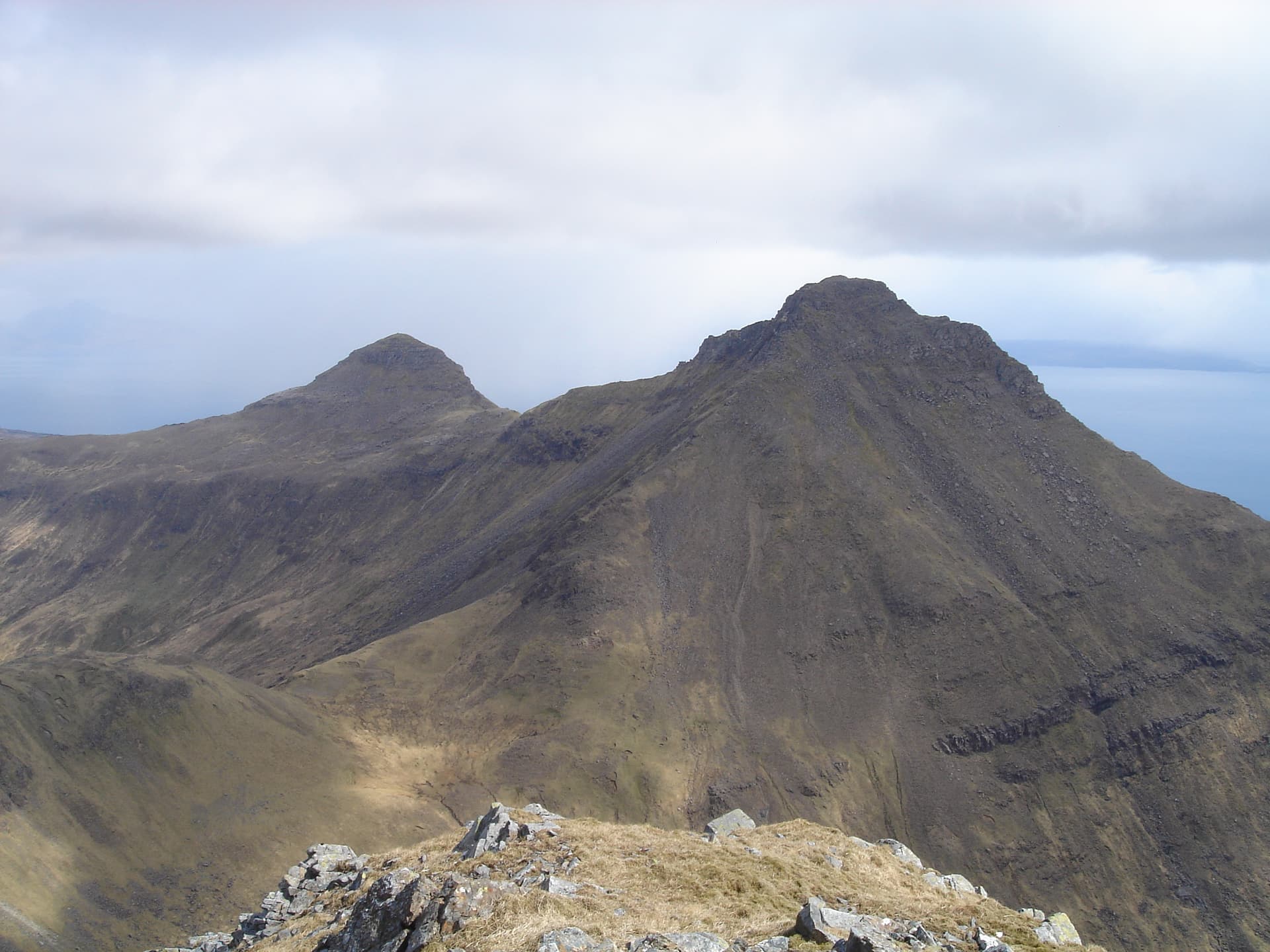
Ainshval is the second-highest summit on Rum, the 781m southern peak of the Rum Cuillin ring. The mountain forms the natural pair with Askival on the ridge traverse — most parties tackle both on the same day. The Norse-derived name reflects the island's Viking heritage; many Rum hills carry old Norse names rather than Gaelic. From the summit the view sweeps across to Skye and along the rest of the Cuillin ring. A serious commitment because of the ferry-only access and the scrambling on the connecting ridge.
Quick facts
- Height
- 781m/ 2562ft
- Prominence
- 326 m
- Distance
- ~22 km
- Ascent
- ~1700 m
- Time
- 8–12 hrs
- Grid ref
- NM378943
- Nearest
- Fort William
- Dogs
- Dogs on lead required near livestockDog-friendly guide ↗
Height and prominence cross-checked against the Database of British and Irish Hills (CC BY).
No GPX track yet
Walked this route? Share your track to help other walkers.
Standard route
island track 20% · rough moorland 25% · volcanic ridge 40% · summit scramble 15%
From Kinloch, walk the path south for around 4km to reach the col below Hallival. Climb Hallival, traverse the scrambling ridge south to Askival, then continue across Trollaval and Ainshval to complete the four-Corbett ring. The descent off Ainshval drops south-west into Glen Harris before turning back north via the loch-side estate track. Allow 10–12 hours for the full ring. For Ainshval alone (not the standard approach), start from Glen Harris and climb the south flank direct.
Terrain
The Rum Cuillin ring is a serious mountain day. Sustained Grade 2 scrambling between Hallival and Askival, mostly Grade 1 between Askival and Trollaval. The basalt is sharp and grippy in the dry, slick when wet. Glen Harris descent is rough underfoot with bog and boulder fields.
In winter
Winter on the Rum Cuillin is for experienced mountaineers — the scrambling becomes Grade I/II winter climbing, daylight is short, and the ferry from Mallaig runs only twice a week in winter. Most parties confine winter visits to the lower ground; the ring traverse is rare outside the May-to-September window.
Kit for this: the winter Munro kit list · which boots take crampons
Best time of year
Getting there
- Glasgow3h 24m
- Edinburgh4h 17m
Ferry access
Mallaig → Rum (Loch Scresort)
- Crossing time90 min
- Summer sailingsMon, Wed, Fri, Sat (Apr–Oct)
- Winter sailingsMon & Thu only (Nov–Mar)
- Book ahead28 days
No cars permitted on Rum — foot passengers only. An overnight stay at Kinloch Castle bunkhouse or Dibidil bothy is strongly recommended.
Book on CalMac ↗OS maps: OS Landranger 39
Mobile signal: No signal on Rum — the island has no mobile coverage
Current conditions
Daylight Today
- Sunrise
- 07:55
- Sunset
- 18:27
- Civil dawn
- 07:17
- Civil dusk
- 19:06
NOAA Solar Calculator · 14 October 2026
Pair with
Curated multi-hill combinations from Ainshval.
Classic round
4 hillsFull Rum Cuillin ring
The iconic Rum Cuillin traverse — Hallival, Askival, Trollaval and Ainshval in a single long day from Kinloch. Descent via Glen Harris.
31km · 2000m ascent · 12 hrs
Two-hill day
Ainshval + Askival
Ainshval and Askival as a focused two-Corbett day — still takes in the full character of the Rum Cuillin without the full ring commitment.
31km · 2380m ascent · 10 hrs
Around Ainshval on the SCOT network
Getting there, basing yourself, and what to do off the hill.
Ainshval — common questions
- What difficulty is Ainshval?
- On the OutdoorSCOT scale, Ainshval comes in at 4/5 — challenging. Expect roughly 22km and 1700m of ascent on the usual route — 8-12 hours for most parties. Ground conditions: The Rum Cuillin ring is a serious mountain day.
- How much drop does Ainshval have?
- The drop is 326m: measured from the summit of Ainshval down to the saddle joining it to higher terrain.
- What's the best month to climb Ainshval?
- Aim for May, June, July, August, September on Ainshval. In the remaining months treat it as a winter hill — full kit, solid navigation, and a look at the relevant SAIS avalanche forecast before you go.
- Can dogs go up Ainshval?
- Dogs are fine on a lead. The route passes livestock or ground-nesting bird habitat, so keep them close throughout.
- Will I get phone signal on Ainshval?
- No signal on Rum — the island has no mobile coverage
- How do I get the ferry to Ainshval?
- Mallaig → Rum (Loch Scresort). Mon, Wed, Fri, Sat (Apr–Oct) in summer; Mon & Thu only (Nov–Mar) in winter. Book at least 28 days ahead. No cars permitted on Rum — foot passengers only. An overnight stay at Kinloch Castle bunkhouse or Dibidil bothy is strongly recommended.
- Is Ainshval safe in winter?
- Winter on the Rum Cuillin is for experienced mountaineers — the scrambling becomes Grade I/II winter climbing, daylight is short, and the ferry from Mallaig runs only twice a week in winter. Most parties confine winter visits to the lower ground; the ring traverse is rare outside the May-to-September window.
Get the OutdoorSCOT weekly
One email a week — new route, hill and bothy guides, seasonal conditions and the odd hard-won lesson. No spam, unsubscribe in one click.