Munro · Glen Coe & Lochaber
Ben Starav
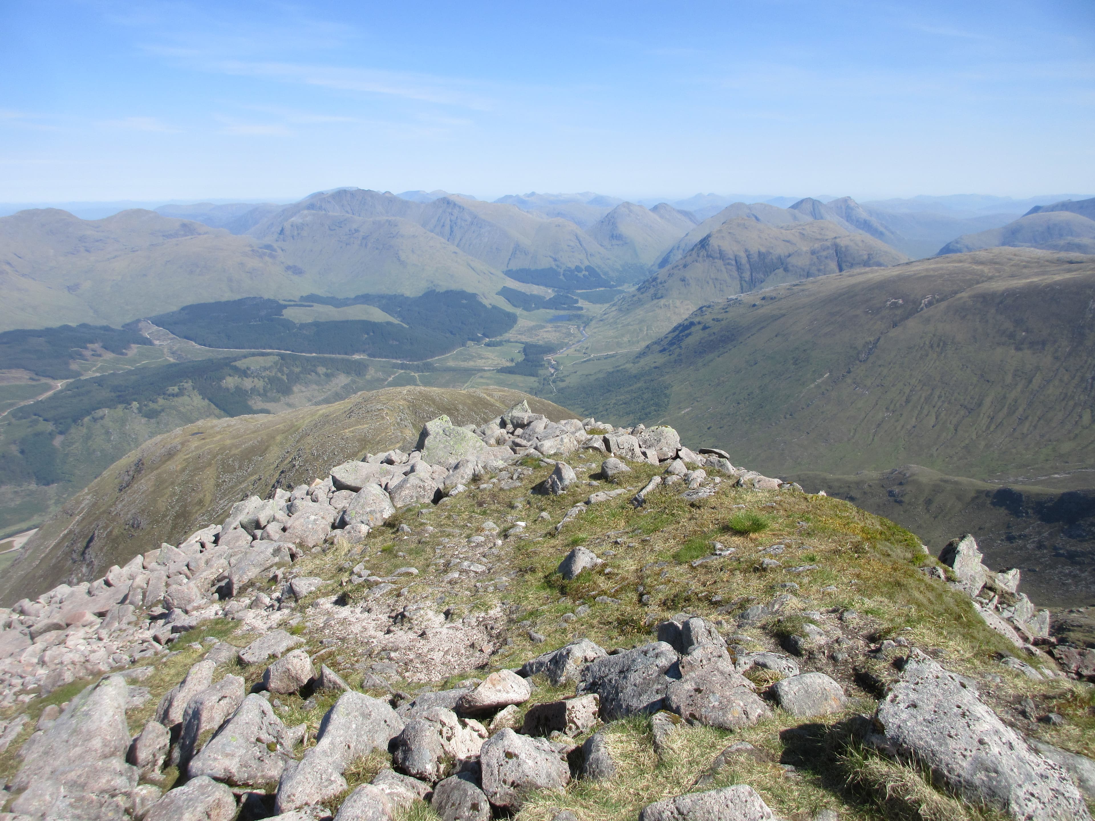
Ben Starav (1079m) is one of the great Glen Etive mountains — a steep granite pyramid that rises almost straight out of the sea-loch at the head of Loch Etive. The north-east ridge is one of the finest single ascents in the southern Highlands: 1000m of climb in under 3km, almost all on clean rock and short turf. Usually paired with Glas Bheinn Mhòr and sometimes the full four-Munro horseshoe over Stob Coir' an Albannaich and Meall nan Eun.
Quick facts
- Height
- 1079.5m/ 3542ft
- Prominence
- 449 m
- Distance
- 18 km
- Ascent
- 950 m
- Time
- 6–9 hrs
- Grid ref
- NN125427
- Parking
- NN137468
- Nearest city
- Oban· 29km
- Dogs
- Dogs on lead required near livestockDog-friendly guide ↗
Height and prominence cross-checked against the Database of British and Irish Hills (CC BY).
No GPX track yet
Walked this route? Share your track to help other walkers.
Standard route
Glen Etive path 20% · Steep rocky hillside 45% · Summit ridge 35%
Park at the bridge over the River Etive at Coileitir, near the head of Loch Etive. Cross the river (footbridge) and the boggy flats, then strike up the steep north-east ridge directly. The ridge is a sustained 1000m climb on grass and broken granite slabs leading to the summit cairn. Most parties continue east along the connecting ridge to Glas Bheinn Mhòr, then descend Coire na h-Uraisge back to Glen Etive. Around 13km with 1300m of ascent for the pair.
Terrain
The Etive river crossing uses a wire footbridge; the flats beyond are wet bog. The north-east ridge has a faint path that comes and goes on grass and short turf, with sections of clean granite slab that need attention in the wet. The summit forms a small rocky plateau, the cairn standing right at the lip of the south-east face. The connecting ridge to Glas Bheinn Mhòr is narrow turf with one rocky step.
In winter
A serious winter mountain. The north-east ridge is exposed to westerly weather throughout the climb; the granite slabs glaze readily with verglas. Cornicing on the summit plateau drops directly onto the south-east face — care with edge approaches. The connecting ridge to Glas Bheinn Mhòr develops avalanche risk after south-westerly loading. SAIS Glencoe is the relevant report. The Glen Etive single-track road can be drifted closed.
This hill is in the Glen Coe SAIS forecast area. Check SAIS forecasts in winter (December–April).
Best time of year
Getting there
- Glasgow2h 55m
- Edinburgh3h 49m
OS maps: OS Landranger 50
Mobile signal: Zero signal above 700m in upper Glen Etive. The glen road is out of range throughout. Preload mapping before the long haul down Glen Etive.
Current conditions
Daylight Today
- Sunrise
- 05:04
- Sunset
- 21:49
- Civil dawn
- 04:10
- Civil dusk
- 22:43
NOAA Solar Calculator · 23 July 2026
Around Ben Starav on the SCOT network
Getting there, basing yourself, and what to do off the hill.
Getting there: Loch Awe station
East shore Loch Awe; Ben Cruachan; Kilchurn Castle
15km from the hill
tripscot.co.uk
On TripSCOTBase yourself in Oban
Argyll ferry hub — Mull, Lismore, Coll, Tiree, Barra
30km from the hill
tripscot.co.uk
On TasteSCOTAfter the hill: Oban
Oban town centre — tiny two-still distillery bridging Highland and West Coast styles
30km from the hill
tastescot.co.uk
Ben Starav — common questions
- How hard is Ben Starav?
- We grade Ben Starav at 4/5, which puts it in challenging territory. The usual route is around 18km with 950m of climbing; allow 6-9 hours. Terrain: The Etive river crossing uses a wire footbridge; the flats beyond are wet bog.
- How prominent is Ben Starav?
- Ben Starav has 449m of topographic prominence — the height of its summit above the highest col connecting it to higher ground.
- Where should I park to climb Ben Starav?
- Standard parking is at NN137468. Check the parking grid reference on an OS map before travel; informal laybys can fill on summer weekends.
- When should I climb Ben Starav?
- The standard good-weather months for Ben Starav are May, June, July, August, September, October. Outside those months, expect winter conditions on the high ground — full mountain kit, navigation skills, and a check of the SAIS avalanche forecast for the relevant region.
- Can I bring my dog up Ben Starav?
- On a lead only — the route crosses ground with livestock or nesting-bird interest.
- What's mobile reception like on Ben Starav?
- Zero signal above 700m in upper Glen Etive. The glen road is out of range throughout. Preload mapping before the long haul down Glen Etive.
- Is Ben Starav safe in winter?
- A serious winter mountain. The north-east ridge is exposed to westerly weather throughout the climb; the granite slabs glaze readily with verglas. Cornicing on the summit plateau drops directly onto the south-east face — care with edge approaches. The connecting ridge to Glas Bheinn Mhòr develops avalanche risk after south-westerly loading. SAIS Glencoe is the relevant report. The Glen Etive single-track road can be drifted closed.
Get the OutdoorSCOT weekly
One email a week — new route, hill and bothy guides, seasonal conditions and the odd hard-won lesson. No spam, unsubscribe in one click.